


NORTHAMPTON, MA / ACCESS Newswire / July 15, 2025 / By Alex Wilkins
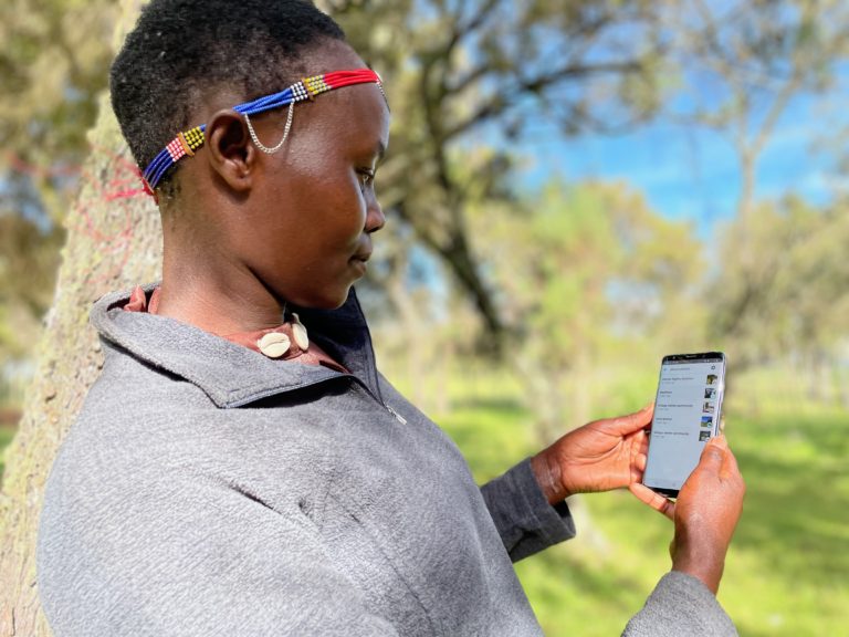
Leah, a member of the Ogiek community of Mt. Elgon, using Mapeo. Photo Credit: Awana Digital.
Leah Kintai heard there were birthing caves used by forest elephants in her community's territory around Mount Elgon in Kenya but had never seen them herself. Leah is a member of the Ogiek community, a group Indigenous to the Chepkitale region of Mount Elgon who have lived in harmony with the forest for generations. However, their way of life and land rights have been repeatedly impacted by efforts to create national reserves and timber farms - plans that can harm the local environment.
In response, the Ogiek community developed a land management system to document their ancestral connection to the land and ecosystems they protect. Recognizing the importance of technology in this effort, they began using CoMapeo, a landscape mapping tool developed by Awana Digital. Since 2021, Leah and other community members have been mapping key ecological sites, such as the salt caves shared by goat herds and forest elephants, and recording environmental destruction caused by logging.
Women in particular play a vital role in this work. "We are rich in knowledge which is important to the community," Leah explains. "We know where to gather firewood and vegetables and find special soil for decorating our artwork. We women also know more about the history and traditional rituals that happen in caves." It was through this mapping use that Leah finally witnessed elephant mothers and calves in the caves, deepening her appreciation of the importance of preserving the land through CoMapeo.
Why User-Centric Mapping Tools Matter
Indigenous communities like the Ogiek steward 80% of the world's biodiversity. Yet, they often lack the infrastructure, resources and tools to sustainably manage their landscapes. Most existing mapping technologies are inaccessible - dependent on internet connectivity, available only in English, and managed through centralized databases that exclude local ownership. Getting appropriate support to make informed decisions for landscape management is critical at the community level as well as at the global level.
The Cisco Foundation has supported two community-led tools that enable local leaders to conduct landscape mapping: Awana Digital's CoMapeo, and Tech Matters' Terraso, developed through community-led design processes, with the aim of supporting effective decision-making by local leaders.
Awana Digital: Building Decentralized Technology
Awana Digital works with frontline communities to use technology to protect their environment and human rights. They partner to co-design and co-develop tools they can use to protect critical ecosystems and Indigenous cultures, working toward a world where all people can participate in the decisions that govern their lives.
The Cisco Foundation funded Awana Digital in 2023 to build the CoMapeo tool, designed in collaboration with Indigenous communities, like the Ogiek, to make it easier to securely map their territories and build a database without ever needing internet connectivity.
In 2024, Cisco extended the funding, and introduced Awana Digital to the Equinix Foundation who also extended funding. Then this year, Cisco and the Equinix Foundation came together funding the enhancement and growth of CoMapeo in new ways. This peer-to-peer database enables local data ownership and offline workflows so that users can seamlessly gather data in remote locations. While most data collection apps are form-centric, CoMapeo utilizes a map-centric approach to make data collection intuitive and easy to learn for non-technical users.
The Ogiek community now uses CoMapeo to keep their land use maps up to date; since 2021, the community mapping team have mapped and actively monitored 80,000 hectares of their territory, benefitting the 4,000 members of the Ogiek community.
But the Ogiek's vision goes beyond mapping. They are committed to showing how their stewardship leads to better conservation and biodiversity outcomes. With support from Oxford University, Forest Peoples Programme, and Awana Digital, the Ogiek are implementing a biodiversity monitoring project to gather evidence of their effective community-based conservation. This data could help them reclaim rights to more of their ancestral land and improve stewardship practices.
One exciting new feature of CoMapeo is its audio recording function, which allows the Ogiek to capture birdsongs in the forest. Elders can then identify these species, enriching the data with local ecological knowledge and keeping track of biodiversity in these lands.
CoMapeo can be used free of charge and is designed to be user-friendly and adaptable, making it easy for anyone to get started with mapping and monitoring their land or environmental projects.
Tech Matters: Tech Solutions That Serve Humanity
The Cisco Foundation also supports Terraso, an open-source mapping and storytelling tool developed by Tech Matters to help communities collect, store, and share landscape data. Designed with local partners, Terraso is accessible and cost-free - making it especially valuable to nonprofits and grassroots organizations that can't afford expensive, commercial alternatives.
In India, Paani Earth faced a significant challenge: Bangalore's rivers were rapidly deteriorating, yet the general population lacked awareness of the city's hydrological systems. The problem was compounded by the absence of a reliable, integrated river data system which can compromise decision-making and lead to mismanagement of water resources.
To address this, Paani Earth used Terraso to create an accessible, interactive map of the region's river systems, compiling data from government agencies, independent studies and satellite sources. With the platform's Story Maps feature, they created an interactive, visual narrative combining data, photos and videos. Cofounder Madhuri Mandava explains the transformation: "Our old website - people called it very academic. People said, 'I don't see why I should care.'"
That changed with Terraso.
The Story of Forgotten Rivers was featured in a local museum exhibit. Its final chapter included a call to action - inviting people to join a WhatsApp group dedicated to river walks and local cleanup events.
"That group now has dozens of members," says Madhuri. "We walk to a nearby river to start rebuilding that connection. We make art and poetry, and discuss how we can take action to protect this space."
Paani Earth plans to expand its use of Story Maps in future projects. With continued support from Cisco and others, Tech Matters is actively improving the platform, based on real user feedback like Madhuri's.
Terraso remains free and open-source, and organizations everywhere are encouraged to use it to tell their place-based stories, advocate for change, and engage their communities.
The efforts of communities like the Ogiek show that when local leaders are equipped with the right tools, they can protect biodiversity and reshape the future of their landscapes. Platforms like Awana Digital's CoMapeo and Tech Matters' Terraso - backed by the Cisco Foundation and the Equinix Foundation - are helping make this possible. As these technologies continue to evolve, they offer powerful examples of how place-based innovation can protect the environment and benefit local communities.
For more information, please visit the Cisco Foundation's Climate Grants Portfolio page.
This blog was written with assistance from Anastasia Baranoff, TekSystems at Cisco.
View original content here.
View additional multimedia and more ESG storytelling from Cisco Systems Inc. on 3blmedia.com.
Contact Info:
Spokesperson: Cisco Systems Inc.
Website: https://www.3blmedia.com/profiles/cisco-systems-inc
Email: info@3blmedia.com
SOURCE: Cisco Systems Inc.
View the original press release on ACCESS Newswire:
https://www.accessnewswire.com/newsroom/en/industrial-and-manufacturing/cisco-local-leaders-using-technology-to-reshape-their-landscapes-1048854
